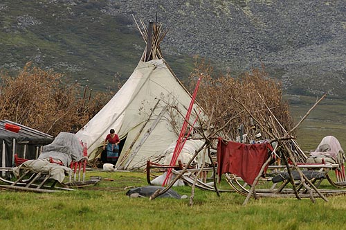
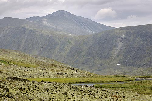
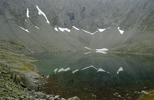
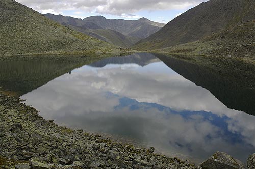
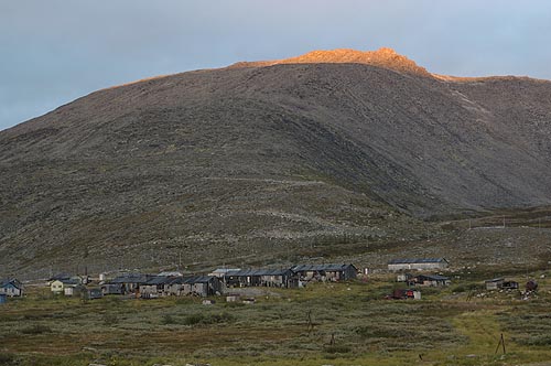
Subpolar Ural


Nomads

For a long time the native people have been coming to this place in summer to feed their reindeer herds. The so-called chum still serves as a traditional shelter. Due to the absence of trees in the area the firewood has to be brought from lower places.

Rudolph

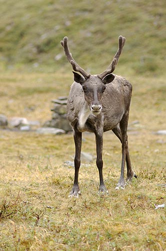
The big herds count up to a thousand reindeers. They give meat and milk, and some are used as draught animals for the wooden sledges. The reindeers are nearly as tame as any domestic animals.
Chum? Reindeer


Plateau of Ruins

What a strange name! Some cities deserve it more. Likely it has something to do with the numerous large blocks remembering ruined buildings.

Karpinsky

One of the highest peaks of the Ural with an elevation of 1,803 m. In August after an exceptional dry summer most of the snow is gone except of large snowdrifts in certain places.
Plateau of Ruins Karpinsky


Naroda

The highest mountain of Ural with 1,895 m, here seen from the Mansi Shor River, a small tributary of the Naroda River in the big valley down below.

Glacier

There are many but small glaciers in the Ural. How long will they last? This glacier lives not far from Khobe Pass.
Naroda Small glacier


Death Valley

Wet and cold, the opposite compared to its namesake in California. I have no clue why it carries this name. Does somebody know the story?

Khobe Yu

One of the many rivers that flows through a beautiful valley (here it carries the name of "Death"). All these lakes result from glaciers that covered and formed the valleys in the past.
Death Valley Khobe Yu


Upper Balbanty Lake

The final end of the Balban Yu Valley reflects in the lake. Upper Balbanty Lake is better to be used in plural, since there are two more lakes to claim this name according to our map.

No. 3

Due to the high number of lakes and the lack of names we did the same as other people before: to count the lakes from the start of the valley. This one is fed by the Khobe Yu.
Upper Balbanty Lake Lake on Khobe Yu

Mushrooms

In August the tundra is rich of mushrooms. Even after the dry and hot summer of 2005 no big effort is necessary to get us a meal.

Aurora Borealis

Only a couple of minutes are left before the arrival of our train back to Moscow, when the sighting of northern light suddenly strikes. A greenish flare creeps over the sky. According to a policeman this is a rare spectacle in Inta (maybe a clear sky is the rare part of it).
Mushrooms Aurora Borealis


Manaraga from Studenchesky Pass

While not the highest peak, Manaraga is one of the most beautiful and famous mountains of Ural. The route along this ridge is the classical way to the summit.

...and from afar

The two summit towers are visible, the first (1,598 m) is easier to climb compared to the second one (1,663 m). The picture was taken from a place in the upper Kapkan Vosh Valley.
Manaraga Manaraga


False Manaraga

Only 1,410 m high, just some five kilometers to the north from the original Manaraga, on the opposite side of the Kapkan Vosh Valley.

Karkar Pass

This pass (1,240 m) leads from one cirque (kar in Russian) into another, hence the name. We crossed the pass in snowfall, something that was new to me in August, but also something I was mentally prepared for on this trip.
False Manaraga Karkar Pass


Village

The road from Inta down to this place is about 130 km long, but takes eight hours to drive. So much for road condition. It was built for the sake of quartz and other mining activities; the workers live in these huts known as "Baza Shelannaya".

Village at Big Balbanty Lake


HOME