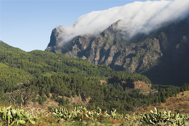
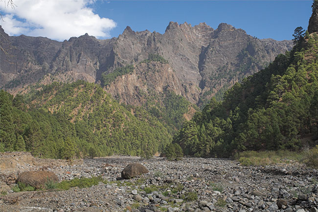
Photographs of La Palma

La Palma


Blue Sky

The picture is betraying, the good weather only present on the western half of La Palma. This is a common situation for Passat winds, when the rising air forms clouds on the eastern slopes, which dissolve as soon as they have crossed the highest point. Even here, at the National Park's visitor center, some raindrops still hit our faces, carried along by the fresh wind.
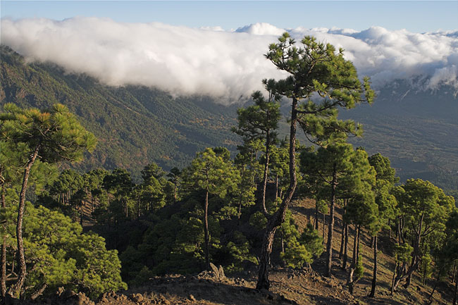
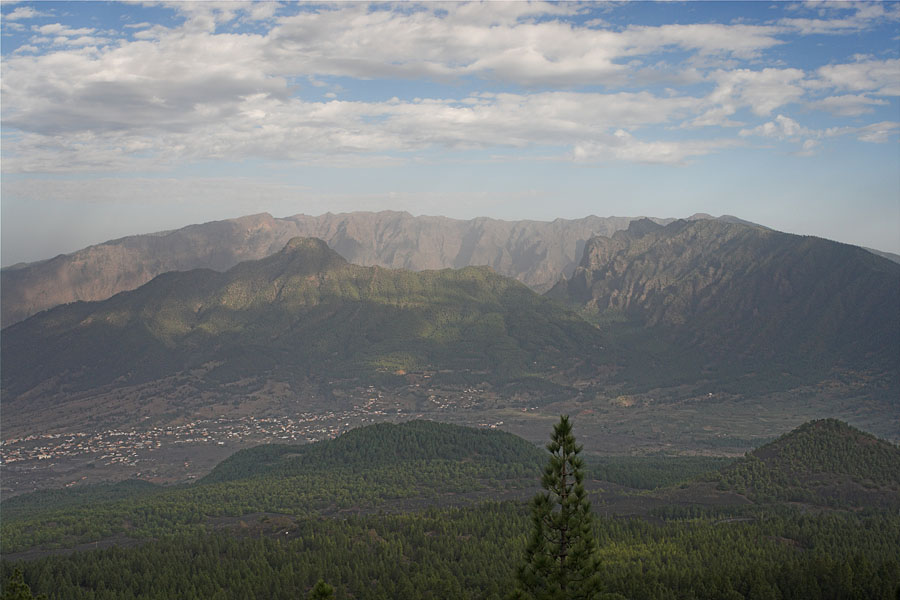
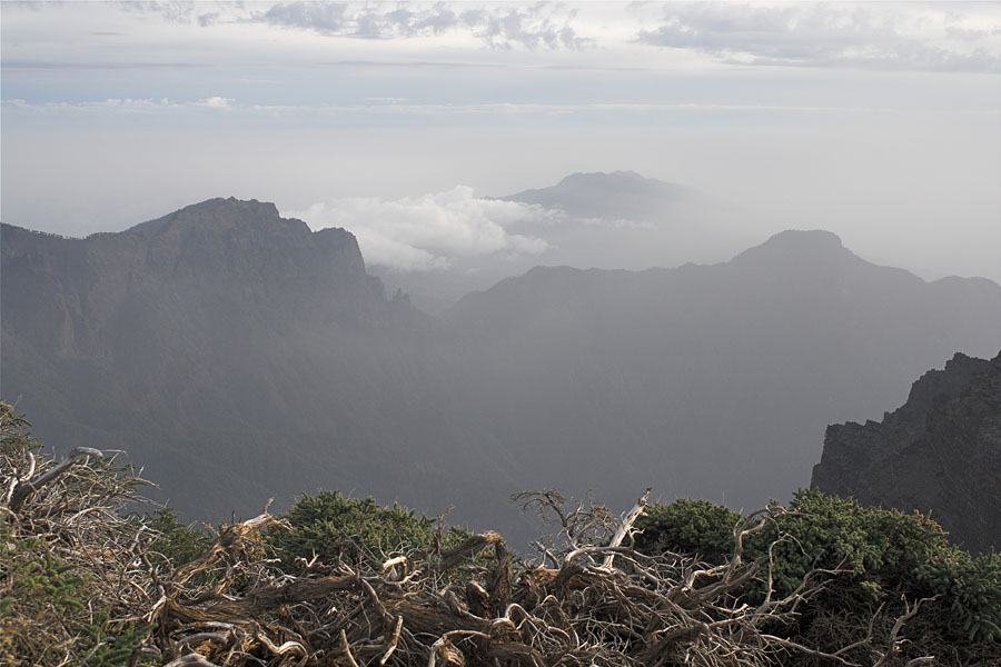
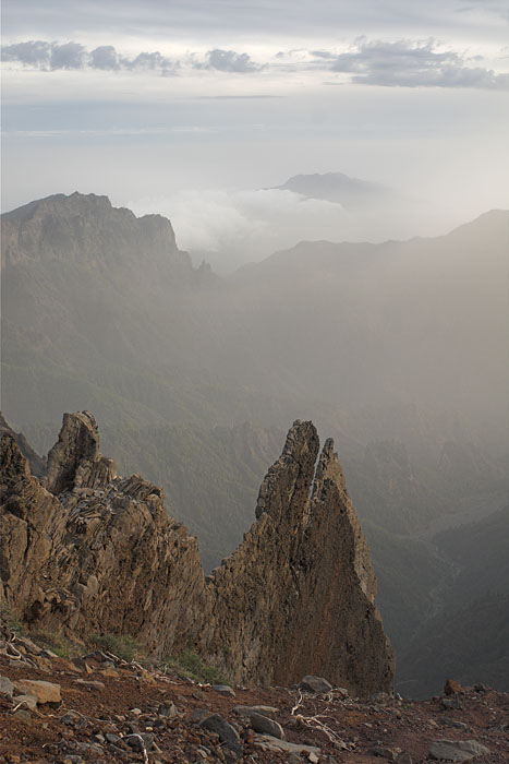
Passat

The same Passat-clouds from a higher point of view, from a point below the Pico de los Cuevos. There are plenty of possibilities to hike under a deep blue sky on a day like this, there is absolutely no need to walk the Cumbre Vieja in endless rain, sharp winds, and no visibility at all.
Clouds Descent from Pico de los Cuevos


Tree

A lone tree stands on the southern edge of the Caldera de Taburiente, not far from the Pico de los Cuevos. The descending sun sheds light at a layer of mist inside the caldera.

Popular Point

Below, underneath the rock, is the Cumbrecita, a popular place to look into the Caldera de Taburiente. It is popular thanks to its parking lot. Limited capacity along with a waiting line for access doesn't recommend it for hiking.
Tree Cumbrecite


Valley

The exit of the Caldera de Taburiente, the deep Barranco de las Angustias, seen from the Bejenado (1854 m).

Bottom

Deep inside the Caldera de Taburiente is this valley floor, actually the bed of the small stream Rio Taburiente.
Barranco de las Angustias Rio Taburiente

Down

The southern end of La Palma hosts the most recent outbreak of volcanism, the Teneguia, where in 1971 a small eruption shaped the landscape with ash and lava streams. This is the view down from the cinder cone San Antonio...

Up

...that was created by an eruption more than 3000 years ago. Given its age it looks fresh, but it got a lifting by another relatively recent eruption in 1677. This picture is the same view like the one on the left hand side, only in the opposite direction from Teneguia.
Teneguia San Antonio


Caldera

The Caldera de Taburiente is not a caldera by geological definition, only by its shape. It was not generated by a volcanic eruption, at least not directly. It was formed in a complex way by the partial collapse of high volcanoes, erosion, and new volcanic activity. The southern part with Bejenado is of much younger age than the rest, while the point from where this photo was taken, the Cumbre Vieja, is again much younger.

Caldera de Taburiente


From the Caldera

Yet another opposite view, here from the caldera's northern rim across the wide valley, over Bejenado on the right, with the Cumbre Vieja in the background. From north to south.

View to the south


Crater

This black hole carries the name Hoyo Negro, the plain translation of what it looks like. It was blown into the earth, or better, out of it, by an eruption in 1949.

Second Crater

Nearby a second crater called Duraznero sent a lava flow downslope to the eastern shore, which stopped short before reaching it.
Crater of Hoyo Negro Crater of Duraznero


San Martin

The colorful volcano of San Martin (1529 m) is the result of an eruption in 1649. From here the view extends to the southern end of La Palma.

End

The southern tip of the island is worth a trip starting from the village of Fuencaliente or Los Canarios or whatever it is called. A lighthouse and an interesting production of sea salt with the volcanoes of Teneguia and San Antonio on top.
From Martin From Salina


Sea

Surrounded by warm waters all year round there are just a few beaches available for swimming on La Palma. And even then a high surf on a windy day makes hiking a better idea. The town of Santa Cruz de la Palma in the background.

West Coast

The older northern half of La Palma consists of steep cliffs. An interesting place is the Cueva Candelaria, a very small bight with a cave-like character, little houses built under overhanging rock, and on calm days offering a good possibility to take a wonderful bath.
Sea Cueva de Candelaria


Observatory

The cloudless sky and the clear air at an elevation of more than 2000 m let to the construction of observatories sponsored by many countries. One of them, the Isaac Newton displayed in the picture, hosts a 2.5 m wide mirror.

The Raven

High up it must be a good place to fly, with steady air to support flight, and neat places to sit. And maybe some tourists to steal from...
Observatory Raven


Wall

La Palma is one of the youngest islands of the Canaries. Nevertheless the caldera's exposed rocks are more than a million years old. Dykes, channels in which flowing magma went for an eruption, are spread all over the wall.

Dyke

Solidified magma in a dyke stands out from the surrounding layers of volcanic debris by its hardness. Later erosion often leaves it exposed as a rock wall.
Wall Up on the Caldera


Ship

Cruise ships are frequent guests in the harbor of Santa Cruz. However, to really get an impression of La Palma it is highly recommended to spend a week of hiking on the island.

Houses

Tired of hiking, a day in Santa Cruz gives it a good break. Some nice ancient houses, good restaurants, churches, and a castillo can be useful to get ready for the next tour.
Ship Houses


BACK