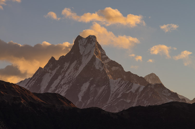
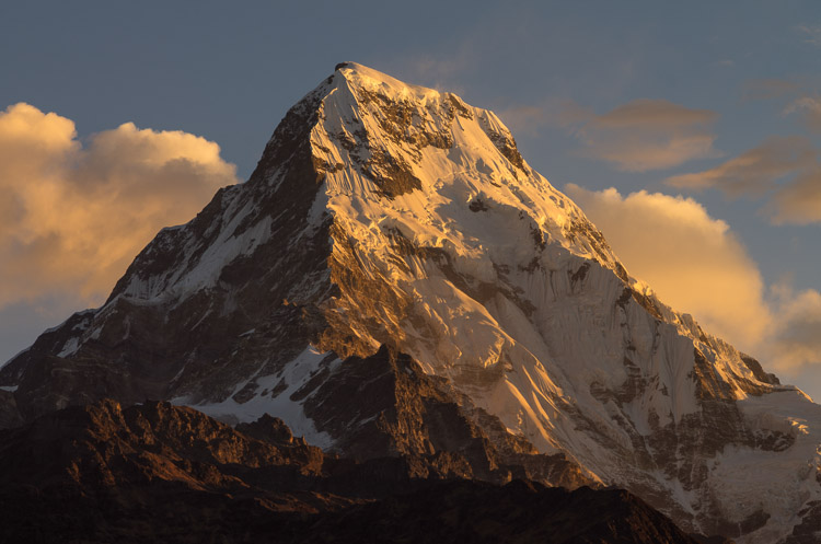
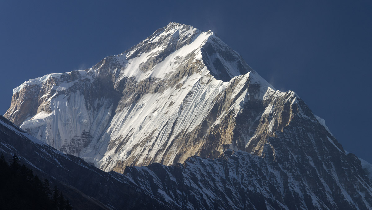
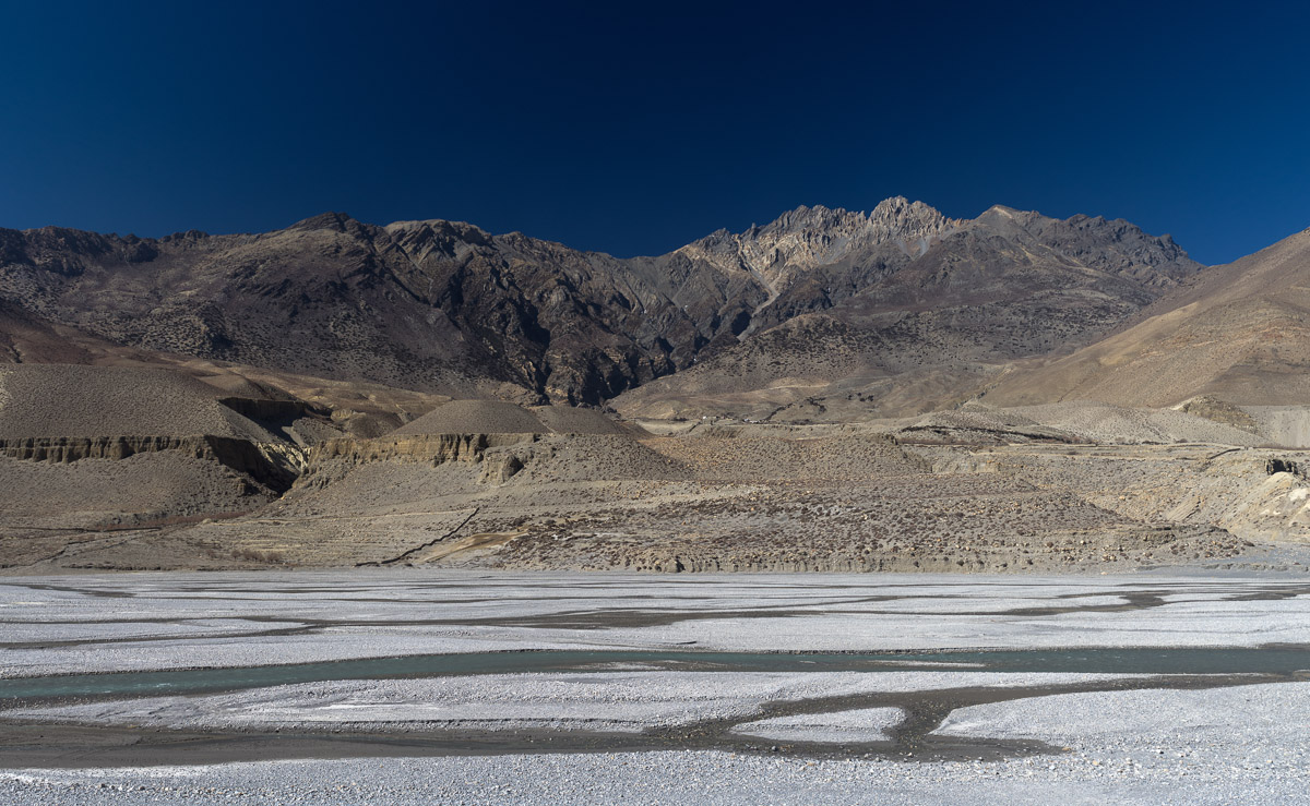
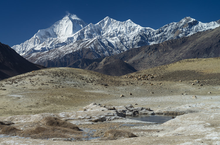
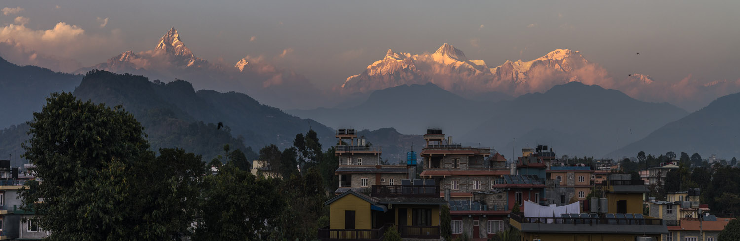
Nepal


Lodge

Morning has broken after a cold night, a good time for a tripod shot at Annapurna straight from the balcony.

Mountain

Actually this is not the Annapurna known from the 8000 m club, it is "just" Annapurna South (7219 m) and Hiun Chuli (6434 m), seen from the village Ulleri.
View from Ulleri Annapurna South from Ulleri


Annapurna Range

At daytime from Poon Hill (3210 m). From left: Nilgiri (6940 m), Annapurna (8091 m), Annapurna South (7219 m), Hiun Chuli (6434 m), and Machapuchare, also called "Fishtail Mountain" (6997 m).

Annapurna Range


Fishtail

Sure this view is the baptist of Fishtail Mountain (Machapuchare, 6997 m). It's Matterhorn-like silhouette doesn't make it look too easy to climb, and in fact it has never been climbed, particularly because it is a sacred mountain.
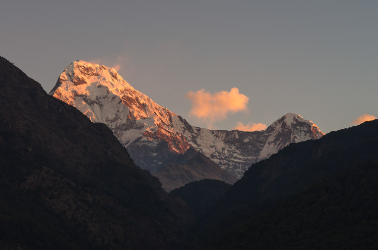
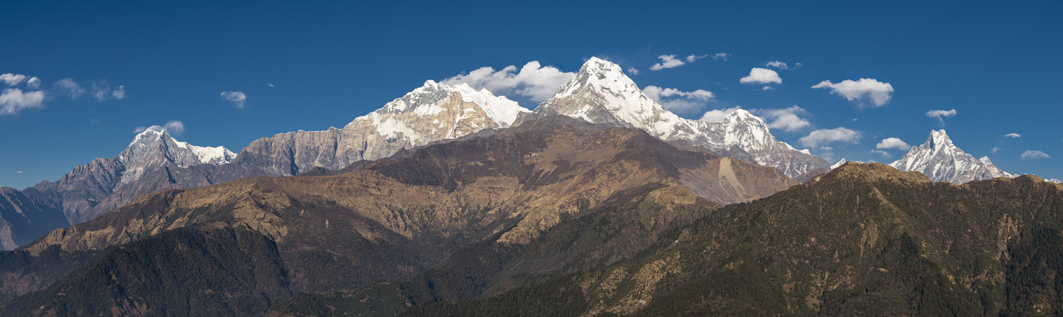
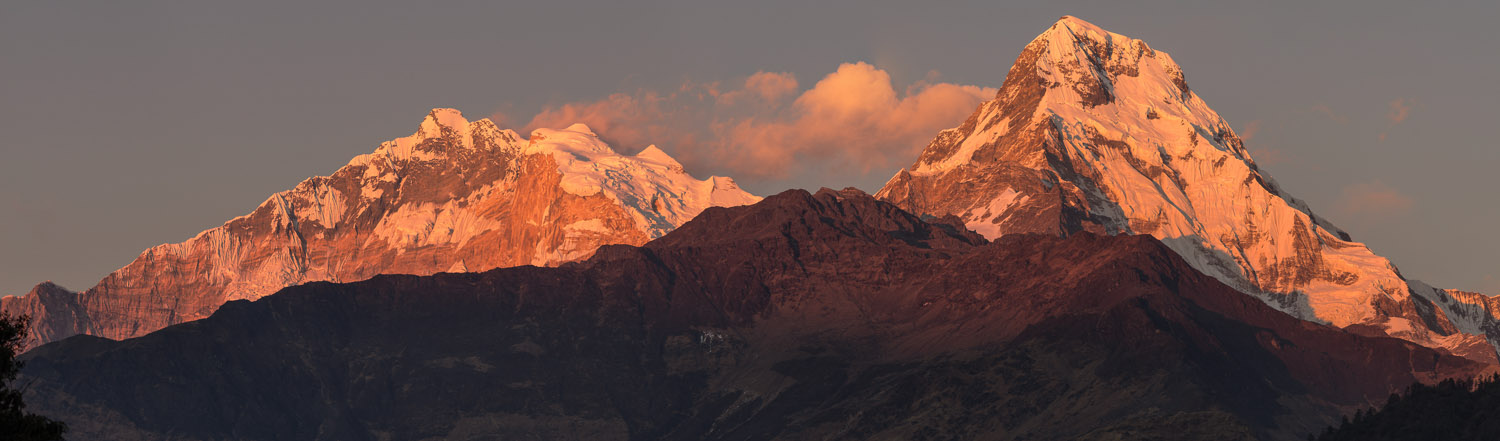
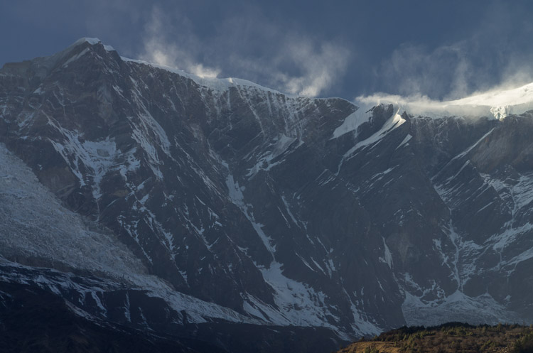
Annapurna South

The Annapurna Range is a whole bunch of summits, whereas the southern peaks are in a more photogenic position from the tourist's perspective when approaching from south, they are closer and hence seem to be higher. The sun sheds light on them all day long, including sunrise and sundown.
Machapuchare Annapurna South


Sundown

Again, Annapurna (8091 m) and Annapurna South (7219 m), this time lit by the evening sun and seen from a high point in the village Ghorepani right underneath Poon Hill.

Annapurna from Ghorepani


Dhaulagiri

The second reason for standing on Poon Hill is to take a look at the Dhaulagiri Range with the mighty mass of Dhaulagiri (8167 m) at the left. Watching it all during sunrise is a spectacle, not only because of the grand sight. A crowd of hundreds of people, a thousand during season, greets the morning light, locals are selling tea and coffee.

Dhaulagiri Range


Gorge

A first look into the Kali Gandaki Valley from a village high on the slopes above the Ghar Khola River, a tributary of the Kali Gandaki.

Goats

The region is relatively populated. Tourists are one source of income, agriculture is another. Goats are professional climbers and eat nearly everything.
View into Kali-Gandaki Goats


River

Nilgiri (6940 m) is towering above the Kali Gandaki Valley near Gharkhola.

Alps?

The Kali Gandaki Valley higher up at Satsaya, now taking on a nice alpine look with a flat, gravel-laden valley floor, surrounded by forest.
Kali-Gandaki Valley Kali-Gandaki Valley


Valley

The Kali Gandaki Valley at Tatopani, a place equipped with a hot spring. The mountain is Nilgiri (6940 m).

Kali-Gandaki Valley


Bridges

This wooden bridge won't last for long. Sure it will be rebuilt again and again after every monsoon. Life in such kind of mountains depends on bridges. It is not everybody's taste to walk over bridges like this. It also requires a special walking style by pacing against the bridge's frequency, especially if you want to take photographs, stomach permitting.
Wooden Bridge Suspension Bridge


Highest

Dhaulagiri (8167 m) is the tallest mountain in the region, but it also has the most massive look. At least from this position.

Dhaulagiri


Wall

The rocks right next to Dhaulagiri's icefall with snow being hurled into the air by strong winds.

Icefall

A tour to the icefall takes a whole day from the valley bottpm. Note the fresh snow on the flanks as compared to the image on the left side.
Rock Face Icefall


Wind

The Kali Gandaki Valley is notorious for strong winds, even in good weather. Under certain conditions the high surrounding mountain tops detour part of the jetstream and stirr things up on the valley floor.

Transport

Apart from the new dirt road built along the Kali Gandaki, a good part of logistics still relies on animals. The main cargo is cement. This oxen train crosses the river near Tukuche.
Windy Valley Transport


New Gate

A tractor drives through the gates of Tukuche. Since the road has been built, live must have changed for local people.

Old Gate

Marpha is an interesting village or town thanks to its old buildings, including this gate.
Gate Marpha


City

Jomsom is the center of the region, a small town equipped with an airport, which struggles with the strong winds. The main street has a Klondike-charm, wires criss-crossing between buildings - a good 10% of the world's electrons are stuck in Nepalease wires.

Jomsom


Crossing

One more bridge across the valley, which is entirely covered by gravel dumped by the river's monsoon floods. Gone is all vegetation, an entirely different landscape than in the days before.

To Mustang

The Kali Gandaki Valley at Kagbeni, the village in the background. The valley proceeds into Mustang, for which a special (and expensive) permit is necessary.
Suspension Bridge Kali-Gandaki Valley


Valley Floor

A shot across the valley, a barren landscape at an elevation of about 2800 m. Despite of the clear blue sky the air is cold.

Kali-Gandaki Valley


Old Walls

The village of Kagbeni must have a history according to the old city-like buildings. You feel yourself thrown back by centuries in time while walking around.

What the...

All right, this comes somewhat unexpected. Maybe the God of Reproduction? God only knows... The buildings consist of stones, wood, and dried mud.
Kagbeni Statue in Kagbeni


Yak

Yaks standing in front of a building almost like guards. These animals are specially suited for living at higher altitude and low temperature.

Calves

Two calves enjoying their young live on a door step. Animals are roaming the streets in Nepali villages until collected by their owner in the evening.
Yaks The Little Ones


Erosion

The whole of the Kali Gandaki Valley has been cut into the upwelling Himalaya. A mix of boulders, gravel, and finer sediments, already eroded from the mountains once, now undergoes a second erosion by rain.

Hotels

Muktinath, famous for the temple, has become a tourist center, as these hotels show. Names such as "California Bar" and "Bob Marley Hotel" are a concession to modern tourism.
Erosion Hotels in Muktinath


Mountain Dessert

A view back to the Kali Gandaki, the river hidden in between the mountain slopes. Any barren landscape, if in arctic latitudes or dessert, is very photogenic.

Peak

The Dhaulagiri (8167 m) from the north-east, with the Tukuche (6920 m) set in front of it.
Landscape Dhaulagiri


From a Distance

The Himalaya seen from Pokhara, in particular the Annapurna Range. The magnificent peak on the left is Machapuchare (6997 m). The following peaks to the right are other Annapurnas, numbered from two to four.

From Pokhara


BACK