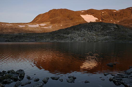
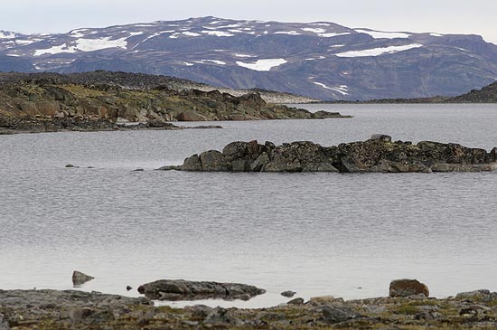
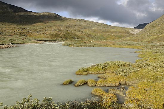
South Greenland - Johan Dahl Land


From the aircraft

This aerial photograph already covers a good part of Johan Dahl Land. Looking northeast, the Inland Ice dominates the horizon with one tongue, the Nordbo Glacier, discharging into Lake Nordbo. The highest mountain in the area, Valhaltinde, looks pretty small from above. Kuussuup Glacier is in the foreground.

Narsarsuaq

While walking up the Johan Dahl Land we take a last view back at the airport. Crossing Kuusuaq River directly down below is better done with a tractor ordered from the Blue Ice Cafe rather than by foot due to the current, and if this can still be overcome, the icy cold of the fresh meltwater should not be forgotten.
Johan Dahl Land from the air View back to Narsarsuaq


From a pass

It is an impressive moment when the ice cap comes in sight for the first time. Straight to the north is the ice-covered Lake Nordbo. This time Valhaltinde (1,690 m) is without doubt recognisable as the highest point of Johan Dahl Land.

Sunset

The same lake as seen on the left-hand photograph directly above the edge of the snow, one of the many lakes left by glaciers that were polishing the rock in (c)older times. While there is no problem to find a lake to camp it is far less easy to have an even place for the tent.
View north Sunset


Lake 930

Since the area is uninhabited, a lake must be big and a moutain must be high to receive an individual name. An intermediate between a name and incognito is an elevation mark on the hiking map, so one can refer to a particular lake using its elevation. A habit also notorious for the military.
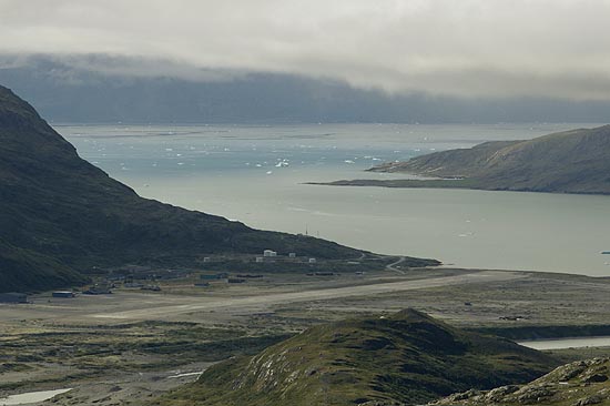
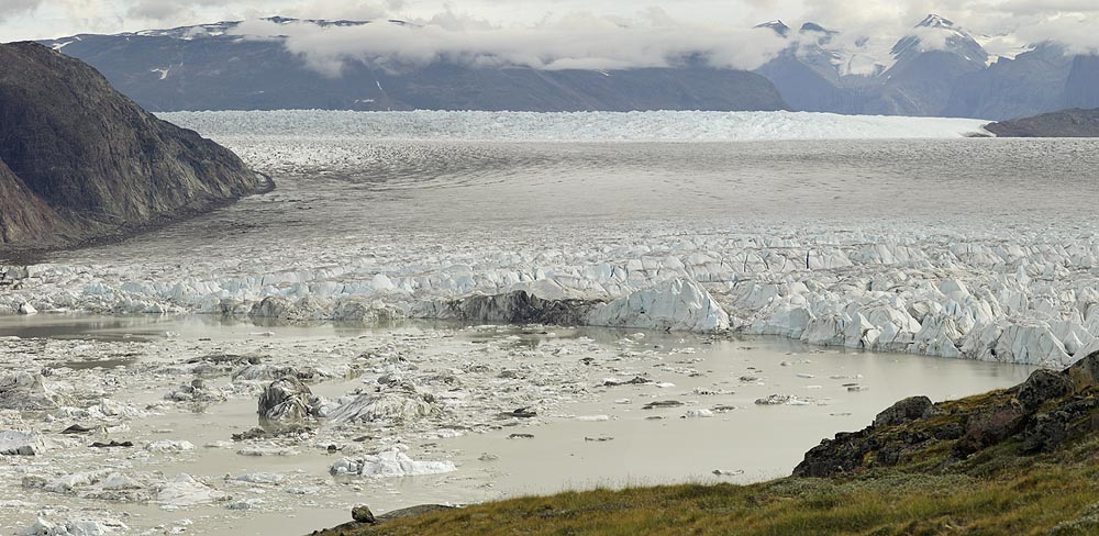
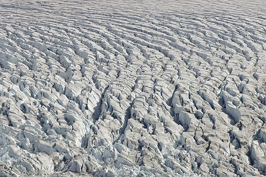
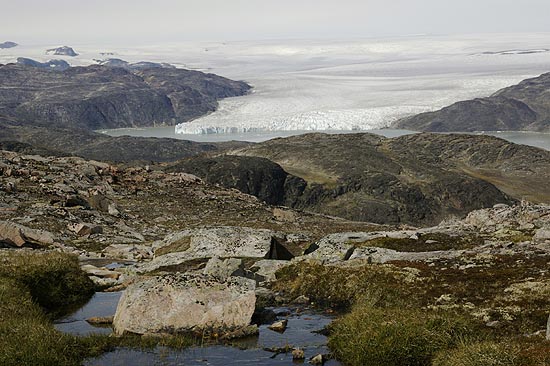
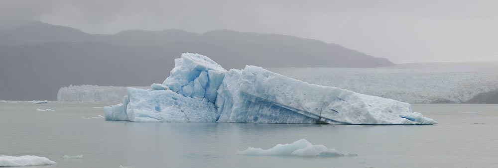
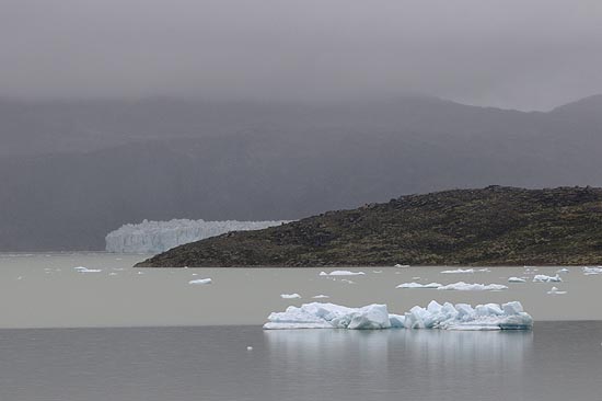
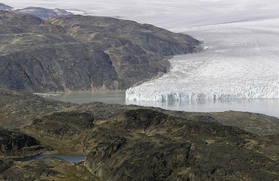
The Hullet

Hullet is Danish and means "Hole". Resembling a lake it is nevertheless something special. The Northglacier, the one seen above, sends its meltwater to the Hullet, while the Sydglacier calves into it from the south, hence the ice. The resulting cocktail, however, frequently lifts the ice of the Sydglacier and drenchs beneath the Kuussuup Glacier towards Narsarsuaq, leaving the poor icebergs stranded in the sand.
View across a lake The Hullet


Sydglacier

The calving edge of Sydglacier, damming up the Hullet. Mellem Landet on the right cuts through the ice stream like the bow of a ship, although in a much slower pace. The discharge into Sydglacier and Kuussuup is small compared with Qooqqup east of Mellem Landet and another tongue further east.

Sydglacier


Nunatak

This Inuit term describes a mountain or rock rising above the surrounding ice cap. The global warming will soon be coming after this one. Thawing back to a normal mountain it will join its many colleagues in the Johan Dahl Land.

Surface

The ice is moving down by gradient, it does so either by repeated melting and refreezing, or it slides over ground, and at proper combinations of temperature and pressure it can even undergo plastic deformation. At high shear rates the brittle ice on the surface cracks up and forms crevasses. Greenland's glacier tongues move fast with the huge reservoir of the Inland Ice at hand.
Inland Ice Surface of Sydglacier


Flowers

The arctic climate keeps the vegetation low, it does not pose much discomfort to the hiker. Despite of the rough climat flowers are abundant, even in late August.

Hares

Two Arctic Hares in full retreat. They had not been too much afraid of the human strangers, the only other animal in the area that could harass them is the Polar Fox. Competition may come from the many sheeps that also feed on the sparse vegetation. Arctic Hares are often seen in groups.
Flower Snowhares


Nordbo

The sight of Nordbo Glacier is an impressive one, as is that of the Inland Ice directly behind. Glaciers in Greenland either calv into the sea or they melt away before reaching the shore. Nordbo as an intermediate is allowed to calv into a lake.

Kukulooq River

When the meltwater of a glacier feeds a lake, the water has to go somewhere. Kukulooq River flows out of Lake Nordbo, thus setting a natural border to the hiking territory. Crossing Kukulooq does not seem impossible at a first glance, but a passage has yet to be found in the murky water.
Nordboglacier Kukulooq River


Iceberg

One of the bigger chunks that came off from Nordbo Glacier. Rainy weather is a natural enemy to the photographer, but in this case it gives the scene its own atmosphere. Blue light travels the longest distance in water until it is absorbed, which makes for the blue shade of the ice. The purity of the Greenlandic ice only enhances the effect.

Iceberg on Lake Nordbo


Ice on Nordbo Lake Nordbo


BACK