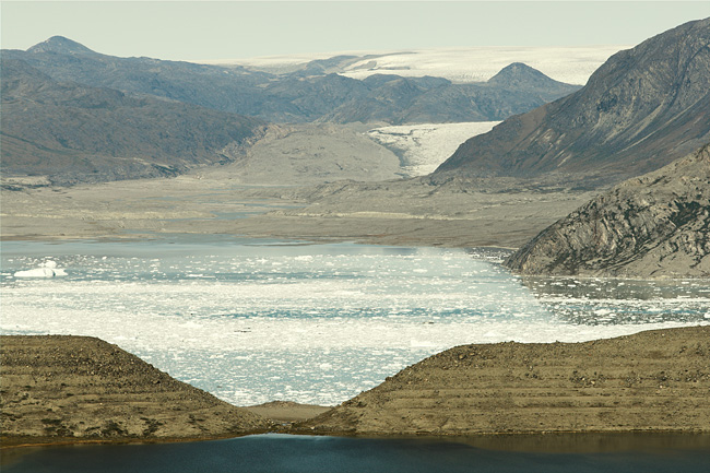
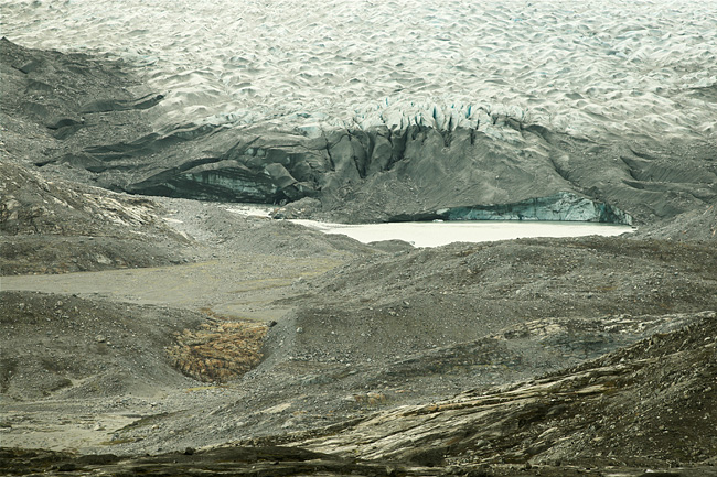
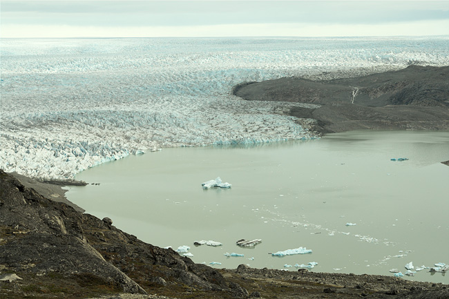
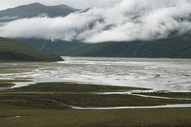
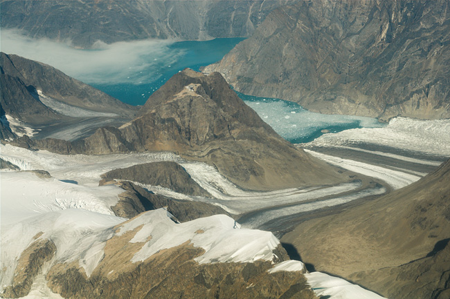
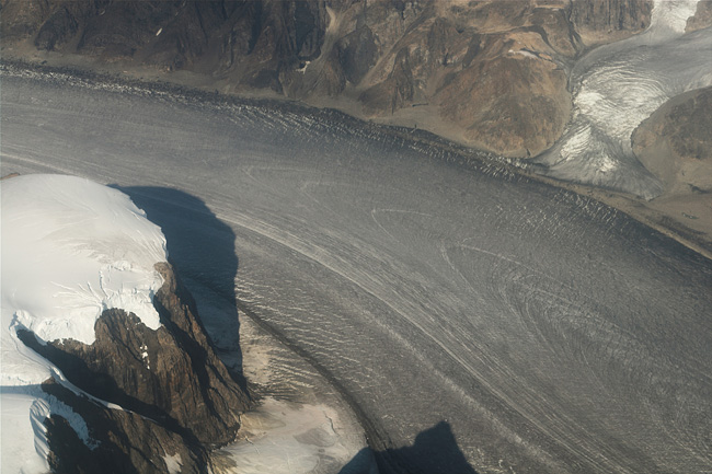
Area of Kapisillit


Cruise Ship

From time to time tourists arrive on board of big vessels and roam the streets of Nuuk. At the Old Harbor, the spot where the settlement has its roots, a sculpture tells the story of "The Mother of the Sea", with the tide washing around it.

Nuuk

The capital of Greenland has some 15000 inhabitants. There has never been a settlement as big as this in Greenland, before modern time shooed many of the hunting Inuit to this place. For long it was known under its Danish name Godhåb.
Old harbor Houses in Nuuk


Icebergs

Calving glaciers, tongues flowing down from the ice shield, create many floating icebergs. They are especially beautiful in bad weather, the more so on photographs rather than in cold practice. Click on the picture to convince yourself.

Icebergs


Moraine

A gate has been broken into a moraine wall created by a glacier that has completely disappeared already a long time ago. Global Warming cannot be blamed as the melting happened before the industrial age. The Kangersuneq icefjord is seen behind the gate with the ice cap looming in the background and a glacier tongue reaching down from it, the Qamanaarsuup Sermia.

Calving Edge

The terminus of Kangiata Nunaata Sermia is at the same time the end of the Kangersuneq icefjord. The rock wall above also gives the impression as if the ice is melting rapidly. While the glaciers are indeed on retreat due to global warming, the process is by far not this dramatic as the marks on the rock wall make us believe.
Icefjord Glacier


Kangersuneq Icefjord

An icefjord is not just a fjord, a deep u-shaped valley carved in by moving glacier tongues. A fjord is called "icefjord" when somewhere, most likely at its end, a glacier calves into its waters, which becomes obliterated by floating ice ranging from small debris through ice floes up to bergs. The low tide leaves the ice stranded along the shore. Four active glacier tongues calve their ice into this fjord, two of which are visible in the background. Click on the picture for more.

Stranded Ice


Tripod

My tripod is standing by to take photographs during the evening, of the Kangiata Nunaata Sermia and the ice sheet behind. It has been a struggle to find a suitable place for the tent, with water nearby, and to ensure this terrific view at the fjord.

Ice

Another stream of ice going down the slopes called Kangaasarsuup Sermia, which doesn't make it to the sea but ends up on higher ground. It is still a long way to the end of this tongue as this photograph shows just a small detail of its flank. The main stream actually moves from left to the right.
Tripod with Iceshield Kangaasarsuup Sermia

Flow

It's the Kangiata Nunaata's broken surface down below, seen from the position on the photograph above. The light is slowly fading away and the camera sits on the tripod. The steeper and faster the flow, the more chaotic the surface of the ice.

Surface

Ice flows by sliding over rock, by melting and freezing, time and again. If the path is steep the ice stretches beyond strength and breaks into numerous blocks with deep crevasses in between. The formation of a water film between ice and rock may cause the ice to slide and thus taking up speed. Rapid progress, called a surge, may follow after years of stagnation or retreat.
Kangiata Nunaata Sermia Iceshield at night


Sunset

Thankfully the sun disappears slowly at this latitude compared to the "ditching" in tropical regions, so there is plenty of time for taking photographs. A disturbing factor was the freshening-up wind, despite of the seemingly good weather, rendering the tripod quite useless for longer lenses and shutter speeds.

Spotlights

Nevertheless the cold and windy evening offered a tremendous view. With the evening sun peeking through some clouds at the northwestern horizon, red spotlights started to wander over the ice. At the beginning of August the night sky is still not dark enough to observe an aurora borealis.
Kangiata Nunaata Sermia


Lake

The meltwater from the Kangiata Nunaata Sermia forms a big lake, called Uukkaasup Tasia or Isvand. Since the glacier is moving downward to the sea, here from right to the left, it doesn't calve much ice into the lake. It's just the water from inside the glacier that accumulates in this lower spot of land. However, there must be a way for the water to also escape underneath the glacier, a drain that must have opened a couple of years ago as a result of a warmer climate. The water level of Isvand has fallen quite a bit as can be judged from marks on the lake shore, and not without consequences.
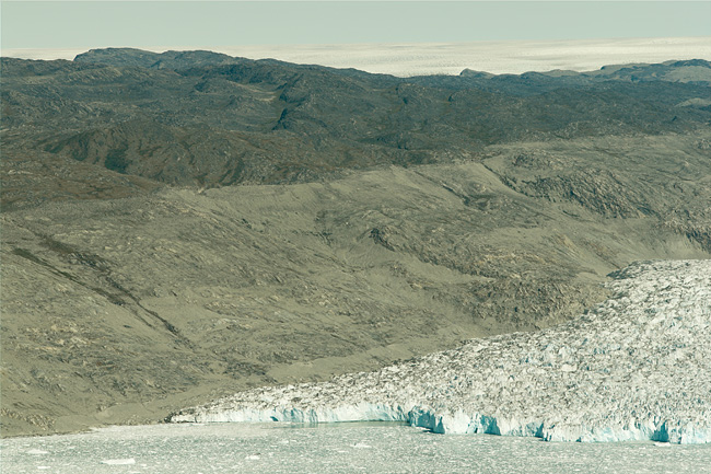
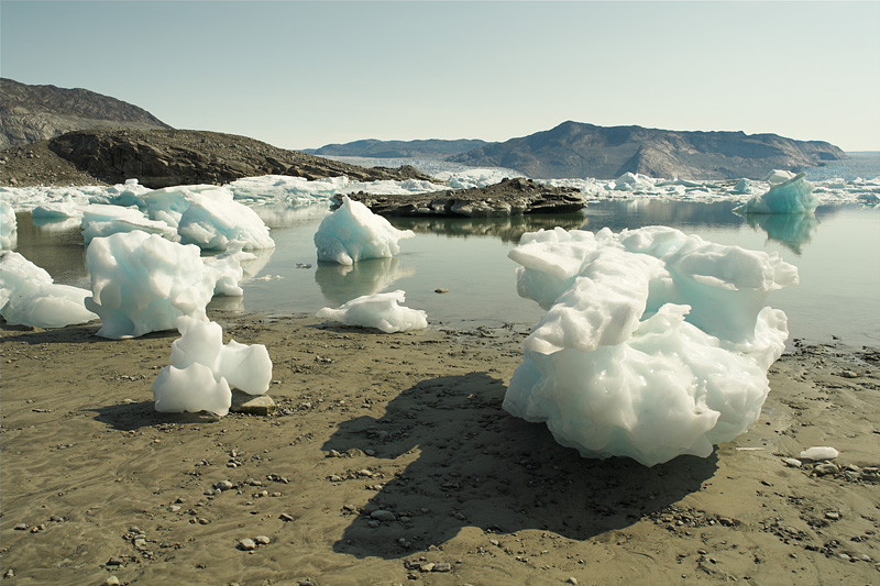
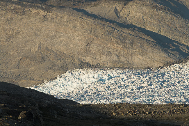
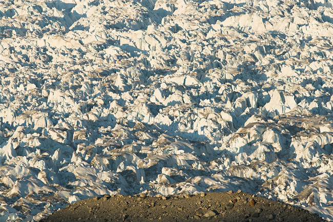
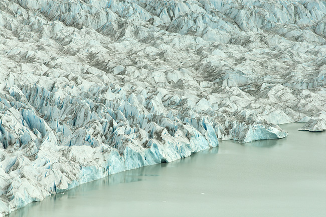
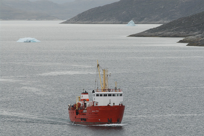
End of Ice

Surely from time to time a chunk breaks off, but this doesn't happen too often as the ice is not really being pushed forward towards the water. The ice is just a passer-by who moves on down into the fjord. Ice doesn't behave just like a viscous liquid. While it pushes ahead it follows more complex rules, it breaks, tumbles, melts, flows as water, freezes over again, shows plastic flow at great pressure, slides along rock, slides on water films, falls down steep slopes, is shattered to pieces, sinters to a solid block. A part of it evaporates. And a lucky piece ends up swimming in the fjord.
Isvand Calving Qooqqup Glacier


Reindeer

The biggest mammal so far in the area is the reindeer. They show up alone or in small groups of two or three. Their antlers can be found everywhere. In August the hunting season opens and a slaughter settles in. Down in the valleys the left-overs from killed reindeer, antlers, bones, carcasses, skulls, give the impression of killing fields, with empty cartridges nearby. The hunt on reindeers plays an important role for the Inuit.

Ptarmigan

The bird appears absolutely helpless, it's little head twitching around for safety. It runs away until it is out of sight, whereas it could achieve the same effect by sticking it's head into sand. Seconds later I show up again pointing the lens at the desperate creature with the funny feathered feet. Finally, with no way out cornered at a rock wall, the ptarmigan suddenly remembers about it's flying capabilities.
Reindeer Ptarmigan


Kuussuaq River

Or what is left of it. It's been a fairly big river fed by the waters of Lake Isvand (see above), but the lower water level of the lake has wiped out the Kuussuaq completely, with the exception of some minor tributaries that have nothing in common with the former discharge. Now, this is really something to be called an alarming sign of the global warming, and maybe it is. On the other side a glacier is an environment capable of rapid changes, even without a climate change.

Another Fjord

The upper part of the Ameralla fjord is filled with sediments up to the brim. Here Nansen's expedition arrived after having made the first crossing of the ice cap in 1888, set up his tents, build canoes and sailed down the fjord to Nuuk. Today this place is called "Nansens teltplads".
Ausmannadalen Ameralla Fjord


Lake

The Qajartariarsuaq is one of the many lakes left over by the glaciers, one of the bigger lakes in the area and the biggest on the route from Kapisillit to Kilaarsarfik, a place with some ruins from the viking period. The picture was taken on the northern end of the lake.

Late

The sun has already settled down near Kapisillit. A piece of Lake Nattoralinnguit Tasiat is visible on the left, whereas on the right the waters of Kapisillit Kangerluat fjord come into view. The river Kapisilik is the only one river of all of Greenland which hosts a population of salmons.
Qajartariarsuaq Lake Evening near Kapisillit


Ship

The cargo ship Angaju Ittuk approaches Kapisillit. The vessel was build in 1984 and is owned by the Royal Arctic Line to supply settlements along the coast. It also takes a load of up to twelve passengers in a simple cabin astern.

Tide

The Angaju Ittuk has moored at the landing stage at Kapisillit. It takes about six hours at a speed of 16 knots to reach Nuuk. A fishing boat has gone to the bottom during low tide.
Appoaching Cargo Ship Angaju Ittuk at Kapisillit


Inside the Fjord

A journey onboard a ship can be a lonely adventure with only the horizon all around. Not so in a fjord, with steep rock walls on both sides, not to mention icefloes and bergs passing by. Then, in the evening, the setting sun still adds much more beauty. If there only wasn't the highly dynamic character of the moving ship, the rattling engine, thus preventing any thought about using a tripod, but also the cold wind on deck. For more handheld pictures click on the photograph.

In Uummannap Sullua Fjord


From Airplane

The comparably small strip between the Atlantic Ocean and the ice cap offers many great places. Unfortunately they are all but easily accessible, not to mention the severe conditions with steep rock walls, fjords, and glaciers. On the other side this guarantees that at least some remote places on this planet remain untouched.

Glacier Flow

This air view provides an interesting look at the flow behavior of a glacier tongue. The debris on the surface outlines the movement of the ice. Parabolic patterns indicate a laminar flow of the inner section, suggesting a plastic behavior. Outer regions seem to behave in a different manner. A camera, mounted to a rock, should be able to document the flow by taking daily photographs. Has anybody tried this?
Glacier Tongue Flowing Glacier


BACK